Geologic Cross Section Tool

More bokeh-hydrogeology!

Slice arbitrary cross sections through a geologic model, and view observation wells/pumping wells on the projected cross section. All built standalone CustomJS style and embedded on our website.

Pretty proud of this. It took a lot of “clever for me” tricks on the python and JS side, from registering mousetap events to developing a quick algo that finds the nearest indices of each stacked raster, then translating that into the appropriate multiline and rect glyphs on the cross section, to orthogonally projecting the wells to the section if they are within a certain snap distance of the section, and ensuring that they are projected to the line segment they are closest to, even if the user keeps on adding segments to their section.

I’ve structured the code in such a way that I can easily build in other arbitrary vector data via subclassing as the “project to the cross section” code is reusable, just the glyphs need to change. River crossings, borehole logs and surficial geology being probably the next things to incorporate.

XS2

Check it out!

https://sites.google.com/aqua-insight.com/profile/showcase/cross-section-tool

8 Likes

Just posting an update I got up on the site now.

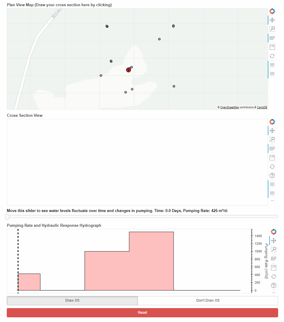
I’ve extended the cross section tool to link to transient data! So in this example, a production well (i.e. one that pumps water out of the ground) changes its pumping rates over time. Nearby wells respond with corresponding changes in their water level. The manner in which these wells respond gives hydrogeologists clues about the system they are trying to understand. A fast immediate response usually indicates a direct hydraulic connection from the observation well to the pumped well while a delayed response indicates something else. The magnitude of response and the relative location of the observation well to the pumping well (is it deeper? is it shallower? how far away is it?) tells us something else as well… but I digress. We use this information to help us drive model conceptualization and parameterization… which ultimately is used to assess drinking water quality and quantity risk.

TLDR: Understanding the spatial and temporal distribution of response to pumping is probably ~50% of the hydrogeologist’s job, and this tool is intended to help them with that :slight_smile:

HG

PS → This showcase is brought to you by whichever developer fixed the multiline hover a ways back. THANK YOU!

2 Likes

This is really terrific, thanks for sharing!!

1 Like

thanks for the awesome information.

thanks my issue has been fixed.