

Hello,
I’m searching for an open-source replacement tile provider for Google Maps and have found GeoViews and HoloViews, both of which are in the PyViz ecosystem. Bokeh is a Core library in PyViz, which is great, but my bokeh serve script works great now and switching to GeoViews or HoloViews is not my goal. Replacing Google Maps is my goal.
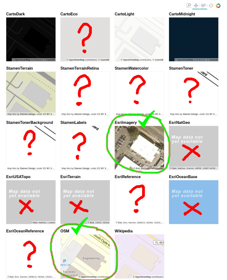
Geoviews has more tile providers integrated but it seems that Bokeh could just as easily provide the same. In particular, the EsriImagery and OSM tile sources appear to work the best as nearly-equivalent Google Maps replacements.
Is there a reason Bokeh does not have the EsriImagery and OSM tile sources integrated?
The image below shows these two seem to work the best, at least for the Florida, USA location I’ve selected. After zooming and panning from the GeoViews demo page, some tile sources don’t even have zoom levels that close:
http://geoviews.org/user_guide/Working_with_Bokeh.html:
What’s the best way to get EsriImagery and OSM plumbed into Bokeh’s tile_providers.py?
The hooks are all there… it seems like these two could work with a modest effort.

