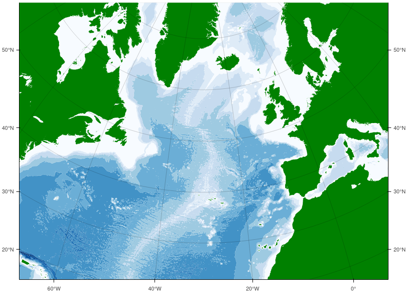
This is the North Atlantic Ocean using ETOPO1 (ETOPO1 Global Relief | NCEI) elevation data. There are 9 sets of filled contours for ocean depth (white to blue), and the land (elevation > 0) is contoured too.
Projection is Lambert azimuthal equal-area projection, with latitude and longitude axis labels. Some of this is really easy to do, some of it isn’t!