After years of coding, debugging, and data crunching for my PhD, I finally turned my research into something you can explore, not just read.
![]() EarthSense — my PhD, now interactive!
EarthSense — my PhD, now interactive!
During my research on surface solar radiation (SSR) fluctuations, I wanted to make the results truly explorable.
So I built EarthSense, a free, open-source web app that lets anyone visualize and interact with the same climate data and radiative transfer model outputs used in my PhD.
Thanks to Bokeh, I was able to transform complex climate datasets and radiative transfer model outputs into a fast, interactive, and visually engaging web app. Bokeh’s powerful combination of Python integration, server-side interactivity, and rich visual capabilities made it possible to bring scientific research to life, bridging the gap between raw data and exploration.
You can:
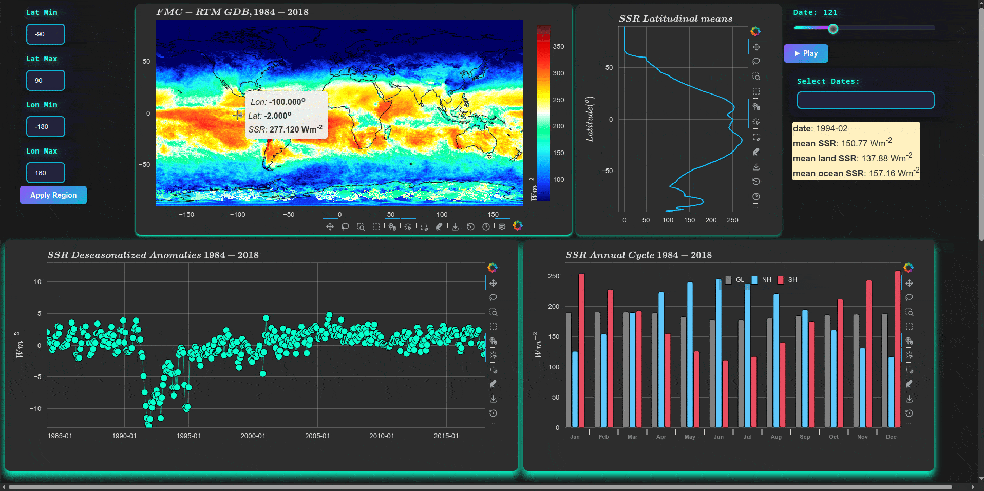
![]() Explore global surface solar radiation (SSR) maps and monthly animations.
Explore global surface solar radiation (SSR) maps and monthly animations.
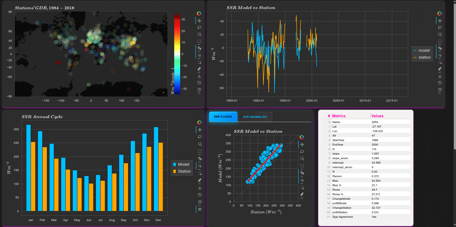
![]() Compare modelled SSR with ground measurements from the GEBA network.
Compare modelled SSR with ground measurements from the GEBA network.
![]() Investigate how atmospheric variables influence/link to SSR changes over time.
Investigate how atmospheric variables influence/link to SSR changes over time.

![]() Live demo: EarthSense Home
Live demo: EarthSense Home
![]() Please note: loading the three apps may take some time due to the large datasets being read online, thus prefer to install it locally.
Please note: loading the three apps may take some time due to the large datasets being read online, thus prefer to install it locally.