What’s the best way to contribute a tile provider demo bokeh serve script?
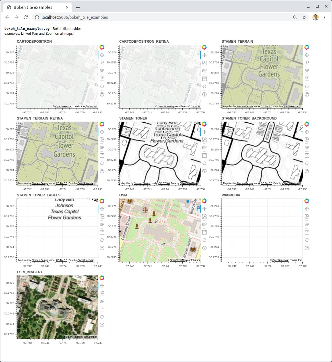
This screenshot shows a demo of all tile providers including the recently contributed OSM, WIKIMEDIA, and ESRI_IMAGERY map providers in tile_providers.py:
Marc
What’s the best way to contribute a tile provider demo bokeh serve script?
This screenshot shows a demo of all tile providers including the recently contributed OSM, WIKIMEDIA, and ESRI_IMAGERY map providers in tile_providers.py:
Marc
@comperem Since this isn’t specifically demonstrating a Bokeh Server capability, per se, my first suggestion would be to convert it to a standalone version (e.g. with output_file and show) and then it could go in the examples/plotting/file directory. I might also suggest re-centering it above a different non-political location.
Ok @Bryan, I’ve updated the bokeh_tile_demo.py to use output_file() and show() and have moved the lat/lon coordinates to a more neutral location.
I don’t think the State Capital of Texas is as much political as it is governmental. But, not everyone is aligned to thinking Texas is the best state in the Union. I certainly am 
 .
.
But your comments have surfaced an interesting issue. When dealing with tile providers and geographic locations, it’s somewhat challenging to select a broadly acceptable and neutral location to show. Any location on the planet, except perhaps the North and South poles is going to be associated with a particular country or government. Switzerland is as neutral as it gets but even then, there are issues.
So, I selected a location with the closest, widely-known affiliation with latitude and longitude.
I have very little preference, actually, and don’t mind changing. I even looked for an overhead view of ESRI, perhaps E-S-R-I spelled on their lawn but didn’t find it. ESRI is one of the most generous corporate sponsors of open-source GIS and global imagery data and would like to give them public credit.
Greenwich Mean Time (GMT) is known and used in GIS and time communities around the world.
How about the UT Austin campus, or Downtown Austin?
Downtown Austin is perfect.
I’m pretty sure that’s what was in the Bokeh mapping demo from earlier this year.